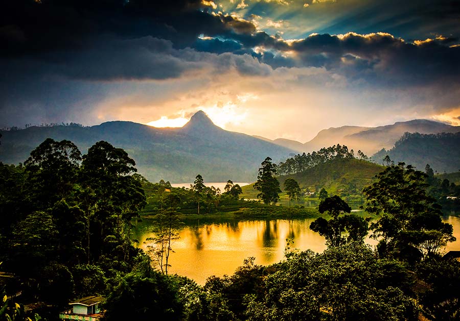
Being one of the best destinations in the world for tourists to visit, the serene lands of Sri Lanka consist of amazing rivers, waterfalls, beaches, and wildlife. Out of them, the rivers in the country that begin in the central highlands and flow into the Indian Ocean play a major role. These rivers not only magnify the natural charm of this wonderful island, but also create opportunities for locals as well as the foreigners to engage in a number of interesting activities such as fishing, kayaking, and adventures. Besides, these rivers contribute immensely to the agricultural sector in Sri Lanka as well. Hence, we thought of sharing with you all about the major rivers in Sri Lanka. Continue reading!
How Many Major Rivers are there in Sri Lanka?
There are 103 rivers in Sri Lanka and the rivers above the length of 100 kilometers are considered the major rivers. Meanwhile, the rivers below 100 kilometers are minor rivers in the country. Accordingly, the following list shows the 16 major rivers in Sri Lanka.
- Mahaweli River
- Malvathu River
- Kala Oya
- Kelani River
- Yan Oya
- Deduru Oya
- Walawe River
- Maduru Oya
- Maha Oya
- Kalu Ganga
- Kirindi Oya
- Kumbukkan Oya
- Menik Ganga
- Gin Ganga
- Mi Oya
- Gal Oya
Let’s get to know more about each of these major rivers in Sri Lanka.
1. Mahaweli River
Starting from the Polwathura (Mahavila area), making the Horton Plains National Park its water source, the Mahaweli River ranks as the longest river in Sri Lanka. It is 335 km (208 mi) in length and has a drainage basin of 10,448 km2 (4,034 sq mi). Out of all the major rivers, the drainage basin of the Mahaweli River is considered the largest in the country. In the same way, the drainage basin of the Mahaweli River covers almost one-fifth of the total area of the island. Thus, this amazing water body is known as the “Great Sandy River” by Sri Lankans.
Polwathura, the beginning of the Mahaweli River is a remote village located in the Nuwara-Eliya district on the border of Nawalapitiya of Kandy District. But, some of the old Sri Lankans believe that this river started from Adam’s Peak. However, it is only a misconception.
Besides, the Mahaweli river joins the Kotmale Oya and the Hatton Oya. Fulfilling the need for water for a nation, the Mahaweli river finally ends at the Bay of Bengal on the southwestern side of Trincomalee Bay. Moreover, the presence of a number of submarine canyons in the bay, makes it one of the best natural deep-sea harbors in the world.
Since this amazing water body runs across the dry zone of Sri Lanka, its tributaries are dammed at several locations. Hence, this allows to uplift the irrigation activities in the dry zone. Mahaweli Development Programme maintains this process by irrigating nearly 1,000 km2 (386 sq mi) of land. Furthermore, six dams of the Mahaweli system contribute to the production of hydroelectricity. Thus, it fulfills nearly 40% of Sri Lanka’s electricity needs.
The Tributaries of the Mahaweli River
Being the longest water body of Sri Lanka which runs more than half a distance from the country, the Mahaweli river gets nurtured by a number of tributaries. The following list contains some of them.
- Kotmale Oya
- Hatton Oya
- Nilamba Oya
- Nanu Oya
- Amban Ganga
- ThalathuOya
- BelihulOya
- Badulu Oya
- Puna Oya
- PundaluOya
- Loggal Oya
- Kirindi Oya
- Uma Oya
- Hulu Ganga
2. Malwathu Oya (Malwathu River)
Out of all the major rivers in Sri Lanka, Malwathu Oya remains the second-longest on the island. It is 164 km (102 mi) long. The birthplace of this river is the North Central Province of Sri Lanka. The main catchment area of the river is considered the Ritigala mountain range which comprises four main peaks while the Inamaluwa mountains are considered the other source of this river. However, it meets the sea at the Gulf of Mannar, near Vankalai in the Northern Province.
Malwathu Oya is a seasonal water body that runs through forest lands and paddy and fulfills the needs of inhabitants to cultivate for their survival. The river basin of the river is nearly 3,284 km2 (1,268 sq mi). Moreover, the average height is nearly 85.5 m (281 ft) above sea level. Similarly, the basin area of Malwathu Oya gets an average annual rainfall of about 1,223 mm (48.1 in).
Tributaries of Malwathu Oya
A number of tributaries nurture Malwathu Oya. Indeed, they have contributed to forming this second-longest water body in the country. The following list brings some of these tributaries of Malwathu Oya.
- Kanadara Oya
- Kal Aru
- Narivili Aru
- Kadahatu Oya
- Maminiya Oya
3. Kala Oya
Kala Oya is another water body recognized as one of the major rivers in Sri Lanka. However, it is the third-longest river on the island. Its approximate length is about 145 km (90 mi). Similarly, the basin size of the Kala Oya is about 2,873 km2 (1,109 sq mi). Furthermore, the catchment area of Kala Oya is about 1,792 square kilometers and it receives nearly 3,169 million cubic meters of rain per year. Yet, only 5 percent of this rainwater meets the sea at Palk Strait.
Tributaries of Kala Oya
This third-longest waterbody in Sri Lanka, Kala Oya, is nurtured by a number of tributaries. The following are some of them.
- Mirisgoni Oya
- Maninda Oya
- Dambulu Oya
- Moragolla Oya
- Hawanella Oya
4. Kelani River
Out of all the major rivers in Sri Lanka, the Kelani river captures a prominent place. Being the fourth-longest river in the country, it runs nearly 145-kilometer-long (90 mi). Adam’s Peak mountain range is considered the birthplace of this amazing water body while it meets the Indian Ocean at Colombo. During its journey to Colombo, the Kelani river passes through the districts like Gampaha, Kegalle, Ratnapura as well as Nuwara Eliya. Furthermore, the Kelani river fulfills nearly 80% of the drinking water needs of the commercial capital of Sri Lanka, Colombo.
Hydrology, Hydrometry, and Usage of Kelani River
Out of all the tributaries of the Kelani river, the Kehelgamu Oya and the Maskeli Oya stay prominent by contributing to hydroelectric production in Sri Lanka. Moreover, they contribute to housing several major power stations, ponds, and reservoirs. Across the Kehelgamu Oya, Norton Reservoir and Castlereigh Reservoir are constructed while Laxapana Reservoir, Canyon Reservoir, and Maskeliya Reservoir are constructed across the Maskeli Oya.
In addition to the water fulfillment in Colombo and the production of hydroelectricity, thousands of Sri Lankans use the Kelani river for fisheries, sand mining, transport, and sewage disposal. The flow of the Kelani river varies depending on the operation of three reservoirs. Thus, during dry seasons, the flow of the river varies from 20 m3/s (706 cu ft/s) to 25 m3/s (883 cu ft/s). Meanwhile, during monsoons, the flow of the river varies from 800 m3/s (28,252 cu ft/s) to 1,500 m3/s (52,972 cu ft/s).
Furthermore, Sri Lankans extract sand from the Kelani River and it amounts in a range between 600,000 m2 (6,458,346 sq ft) to 800,000 m2 (8,611,128 sq ft) annually. Unfortunately, this has caused the river bed to sink by approximately 10 cm (4 in) each year. Saline intrusion in the dry season and flooding during the monsoon happens as a result of it.
Bridges over Kelani River
Since the Kelani river is one of the longest rivers in Sri Lanka, a number of bridges are constructed across it. The following table shows some of them.
| Name of the Bridge | Located Road |
| New Kelani Bridge | Colombo – Kandy Road |
| Mattakkuliya Bridge | Mattakkuliya – Hekitta Road |
| Kelanisiri Bridge | Kelanimulla – Kelaniya Road |
| Kaduwela Bridge | Kaduwela – Kandy Road |
| Hanwella Bridge | Hanwella – Urapola Road |
| Behenella Bridge | Thaligama – Behenella Road |
| Garagoda Bridge | Yatiyantota – Magammana Road |
| Karawanella Bridge | Colombo – Hatton Road |
| Pugoda Bridge | Kosgama – Pugoda Road |
| Sri Lanka – Japan Friendship Bridge | Madampitiya – Peliyagoda Road |
| Gurugalla Bridge | Talduwa – Meewitigammana Road |
| Railway Bridge | Main Railway Line |
| Nawagamuwa Bridge | Nawagamuwa – Mapitigama Road |
| OCH Bridge | Outer Circular Highway |
Cultural References of Kelani River
There is a close connection between the Kelani river and the Sinhala Buddhist culture of Sri Lanka. That is because the Kelani river begins at Adam’s Peak, which is one of the most sacred places in Sri Lanka, and flows by the Kelani Raja Maha Viharaya, a sacred religious attraction of Buddhists. Owing to this reason, there are even a number of folk songs in Sri Lanka that talk about the Kelani river.
In addition to its popularity in Sri Lanka, the Kelani River was famed internationally a few years ago. This is because the Academy Award-winning “The Bridge on the River Kwai” was filmed on this river in the area of Kitulgala.
5. Yan Oya
Being the 5th longest river in the country, Yan Oya comes under the list of major rivers in Sri Lanka. From the beginning to the end where Yan Oya meets the sea, it runs an approximate distance of about 142 kilometers (88 mi). The catchment area of this waterbody is about 1,520 square kilometers and it gets approximately 2,371 million cubic meters of rain per year. However, only around 17 percent of this water reaches the sea at Pulmoddai.
Yan Oya Project
Yan Oya Project is the largest irrigation project conducted in the North Central Province of Sri Lanka. The Ministry of Irrigation & Water Resources Management of Sri Lanka conducts this to provide irrigation facilities for agriculture in Anuradhapura and Trincomalee Districts with the support of the Yan Oya reservoir. This reservoir was created by constructing a dam across the Yan Oya at Pangurugaswewa in the Trincomalee district. However, this project supplies irrigation facilities during both seasons Yala and Maha. In addition, the project provides drinking water facilities to Trincomalee town round the clock.
6. Deduru Oya
Out of all the major rivers in Sri Lanka, Deduru Oya stays prominent by being the 6th longest river in the country. It runs across five districts and four provinces with an approximate length of 142 km (88 mi) until it meets the Indian Ocean at Chilaw. Deduru Oya has a catchment area of about 2,620 square kilometers and it gets nearly 4,313 million cubic meters of rain per year. However, only 27 percent of the water reaches the sea. Furthermore, the basin size of Deduru Oya is about 2,620 km2 (1,010 sq mi).
A number of tributaries nurture this amazing waterbody while it is a long way from the beginning to the end. Kolamunu Oya, Hakwatuna Oya, Ratwila Ela, Kospothu Oya, Maguru Oya, Kimbulwana Oya and Dik Oya are some such tributaries.
7. Walawe River
Walawe is another major river in Sri Lanka that runs nearly 138 km (86 mi) and nurtures the Ratnapura and Hambantota districts of Sri Lanka. Adam’s Peak mountain range is considered the source of this water body. While it’s way to meet the Indian Ocean at the coastal town of Ambalantota, it passes through the towns like Padalangala, Mamadala, Nakulugamuwa, Angunakolapelessa, Uswewa, Tunkama, and Ridiyagama. However, the annual rainfall in these areas differs from each other. Furthermore, the river basin of the Walawe river covers an area of approximately 1,000 square miles.
Walawe River and its tributaries are enriched with a number of aquatic plant species, aquatic fauna species as well as fish species. In addition, some expensive trees like Ebony are commonly visible along the river banks. Indeed, they further magnify the significance of Walawe river.
8. Maduru Oya
With an approximate length of 135 km (84 mi), Maduru Oya flows down from the North Central Province of Sri Lanka. Maduru Oya National Park is the main catchment area of this river. It receives nearly 3,060 million cubic meters of rain per year. Yet, only 26 percent of the water reaches the Indian Ocean at Kalkudah in the Eastern Province of Sri Lanka.
Maduru Oya Dam
Maduru Oya Dam is built across the Maduru Oya in Bandanagala in the Eastern Province of Sri Lanka in order to enrich the area with irrigation activities. Thus, it forms the Maduru Oya Reservoir. It has a catchment area of approximately 453 square km. Furthermore, the Mahaweli Authority of Sri Lanka planned to construct a Solar Power Station over the surface of this reservoir. Anyone who visits the Maduru Oya Dam has the chance to enjoy the wildlife in Sri Lanka at the Maduru Oya National Park which is located next to the dam.
9. Maha Oya
Maha Oya is one of the major rivers in Sri Lanka that marks its beginning from the Nawalapitiya and Aranayake areas. After running nearly 134 km (83 mi), this water body meets the Indian Ocean at Kochchikade, Negombo in the North-Western province. And the significance is, running across four provinces and five districts, Maha Oya fulfills the water requirements of more than 1 million people living by the river with the support of its 14 water supply networks.
The catchment area of Maha Oya is nearly 1,510 square kilometers and receives an annual rainfall of 3644 million cubic meters approximately. However, 34 percent of this rainwater meets the sea. Furthermore, this amazing water body creates the Asupini Ella, at Ganga Ihala Korale, Rakshawa in Aranayaka, Kegalle of Sabaragamuwa Province, which is one of the most stunning waterfalls in Sri Lanka. In addition, Maha Oya flows across the ancient Mawanella Bridge which is the oldest operational brick bridge in Sri Lanka.
10. Kalu Ganga (Black River)
Originating from the Adam’s Peak mountain range, Kalu Ganga flows down through the Ratnapura and Kalutara districts and meets the sea at Kalutara town. The length of this river is about 129 km (80 mi) and the river basin is approximately 2766 km2. Thus, Kalu Ganga is considered one of the major rivers in Sri Lanka.
Sinharaja Forest Reserve and the mountainous forests in the Central Province stand as the major sources of water for the river. Kalu Ganga receives a very high annual rainfall of 4000 mm and the lower flood plain suffers from frequent floods during the Southwest monsoon season. This is because of the hydrological and topographical characteristics.
Furthermore, Kalu Ganga has the second largest river basin on the island and its catchment area gets the highest rainfall in Sri Lanka. In addition, the lower basin part of Kalu Ganga contains mild gradients while the upper part contains steep gradients.
Kukule river is one of the major tributaries of Kalu Ganga.
11. Kirindi Oya
In ancient times, Kirindi Oya was known as Karinda Nadee. It originates from Bandarawela and meets the Indian Ocean at Bundala in the Southern province of Sri Lanka. Kirindi Oya runs about 117 km (73 mi) across the Uva and Southern provinces while fulfilling the need for water for thousands of lives. Thus, it is considered one of the major rivers in Sri Lanka.
12. Kumbukkan Oya
Starting from the Dombagahawela in the Monaragala district, Kumbukkan Oya flows down approximately 116 km (72 mi). However, it is the twelfth-longest river in Sri Lanka.
Moreover, Kumbukkan Oya provides water for flora and fauna spread over two provinces and two districts. The catchment area of Kumbukkan Oya is about 1,218 square kilometers and its annual rainfall ranges at around 2,115 million cubic meters approximately. Yet, only 12 percent of this water meets the sea at Arugambay in the Trincomalee district.
13. Menik Ganga
Menik Ganga means the River of Gems. It has got this name because the Sri Lankans believe that precious stones of all kinds are present in this river. However, in ancient times, this historic river was known as Kappakandara-Nadi as well as Kapikandur-ho.
Since Menik Ganga flows across Kataragama, which is the city of the God Kataragama, it has much significance. Devotees who visited Kataragama in the past used to cleanse themselves from this river prior to engaging in religious activities.
Being the thirteenth-longest river in Sri Lanka, Menik Ganga flows approximately 114 km (71 mi) from its beginning to the end. The birthplace of this water body is believed to be the Namunukula mountain range in the Uva province while it enters the sea via Yala National Park after passing two provinces and two districts.
Moreover, the catchment area of Menik Ganga is approximately 1,272 square kilometers while it receives about 2,124 million cubic meters of rain per year. However, only about 10 percent of the water reaches the sea. The basin of Menik Ganga is approximately 1,272 km2 while the annual mean precipitation in the basin is about 1,496 mm. In the same way, Menik Ganga has an estimated natural annual flow of about 347 million cubic meters. Furthermore, a number of reservoirs and anicuts are built across this river. Some are as follows.
- Buttala Anicut
- Karawila Wewa
- Kongaha Wewa
- Yudaganawa Wewa
Being one of the major rivers in the country, Menik Ganga helps people in many other ways. Provision of drinking water and fulfilling agricultural needs are some of them. In addition, Menik Ganga gives a lot of natural beauty and attraction to the cities it flows through.
14. Gin Ganga
Originating from Gongala Mountain range, near Deniyaya, bordering the world-famous Sinharaja Forest Reserve, Gin Ganga, or the River Gin flows down in the southern region of Sri Lanka as one of the major rivers in the country. The length of the River Gin is approximately 115.9 km (72 mi).
After passing the major cities like Neluwa, Tawalama, Hiniduma, Nagoda, and Baddegama, River Gin meets the Indian Ocean at Gintota, just 5 kilometers north of historic Galle city. Nagare Ela and Divithura Ela are the left tributaries of River Gin while Holuwagoda Ela is the right tributary. Furthermore, a number of bridges are built across this amazing water body. The following list brings some of them.
- Deniyaya Bridge
- Mederipitya Bridge
- Neluwa Bridge
- Waduwelivitya Bridge
- Gammadegoda Bridge
- Mapalagama Bridge
- Unanvitya Bridge
- Agaliya Mulkada Bridge
- Gin Ganga Bridge (E01)
- Halpotha Bridge
- Kiribathawila Bridge
- Dodangoda Bridge
- Wakwella Bridge
- Gintota Railway Bridge
- Gin Ganga Bridge (Gintota)
The Wakwella Bridge which was built in 1999 across River Gin was the longest bridge in Sri Lanka at the time.
15. Mi Oya
Mi Oya, the fifteenth-longest river in Sri Lanka, flows down from Saliyagama to Puttalam as one of the major rivers in the country. Its length is about 108 km (67 mi) approximately. The catchment area of Mi Oya is about 1,024 square kilometers while it receives nearly 1,596 million cubic meters of rain per year. However, only 3 percent of this water reaches the Indian ocean.
Flowing down through the North-western province of Sri Lanka which belongs to the dry zone of the country, Mi Oya renders a great service to all the living beings who look for the need of water.
16. Gal Oya
Gal Oya is one of the major rivers in Sri Lanka which is famous for the Gal Oya dam built across it. This waterbody is 108 km (67 mi) long and it begins in the hills east of Badulla and meets the sea at Kalmunai in the Ampara district. Moreover, Gal Oya stays in 16th place on the list of longest rivers in Sri Lanka.
In 1948, Gal Oya was dammed at Bintenne to form the largest reservoir in Sri Lanka, the Senanayake Samudra. This dam is about 3,600 ft (1,100 m) and 140 ft (43 m) in length and height respectively. This happened as a part of the Gal Oya scheme. Moreover, this project formed a river basin of 100,000 acres which is still useful for the cultivation of paddy, sugarcane, chilies, and potatoes in the Uva and Eastern provinces. In addition to this, a small hydroelectric power station powers in the Gal Oya dam.
Besides, Gal Oya has a close bond with the Gal Oya National Park. It is the main catchment area of Senanayake Samudraya. Similarly, it is a good spot for the sight of elephant herds throughout the year.
The Bottom Line
After all, no holiday in Sri Lanka would be complete without a visit to a major river. The soothing winds that blow from the rivers, and the spectacular sceneries that the rivers create by coupling with the greenery in the surroundings, are sure to offer you the perfect atmosphere to relax a bit, and spend some time with nature. And why not? These rivers in Sri Lanka are the best for some beautiful photographs too. So, never miss visiting a river in Sri Lanka, while you are traveling on this splendid island. Happy and safe traveling!

